Surroundings
Sabina, between hills and history
Montopoli di Sabina lies in the province of Rieti, on the hills between the Tiber valley and the Via Salaria: countryside calm less than an hour from central Rome.
Approximate distances
- Central Rome
- about 45 minutes by car
- Fiumicino Airport
- about 55 minutes by car
- Farfa Abbey
- a few minutes by car
Where we are
This map is provided by Google Maps. If you load it, Google may collect data and use cookies.
Cookie policyWhere to go
What to see around the house
From the village of Montopoli to abbeys, medieval villages and the Farfa gorges, all the way to Lake Turano, Mount Terminillo and the Marmore Falls: our selection of places and experiences, ordered by distance. Tap a place to open it on the map.
In the village
Montopoli di Sabina
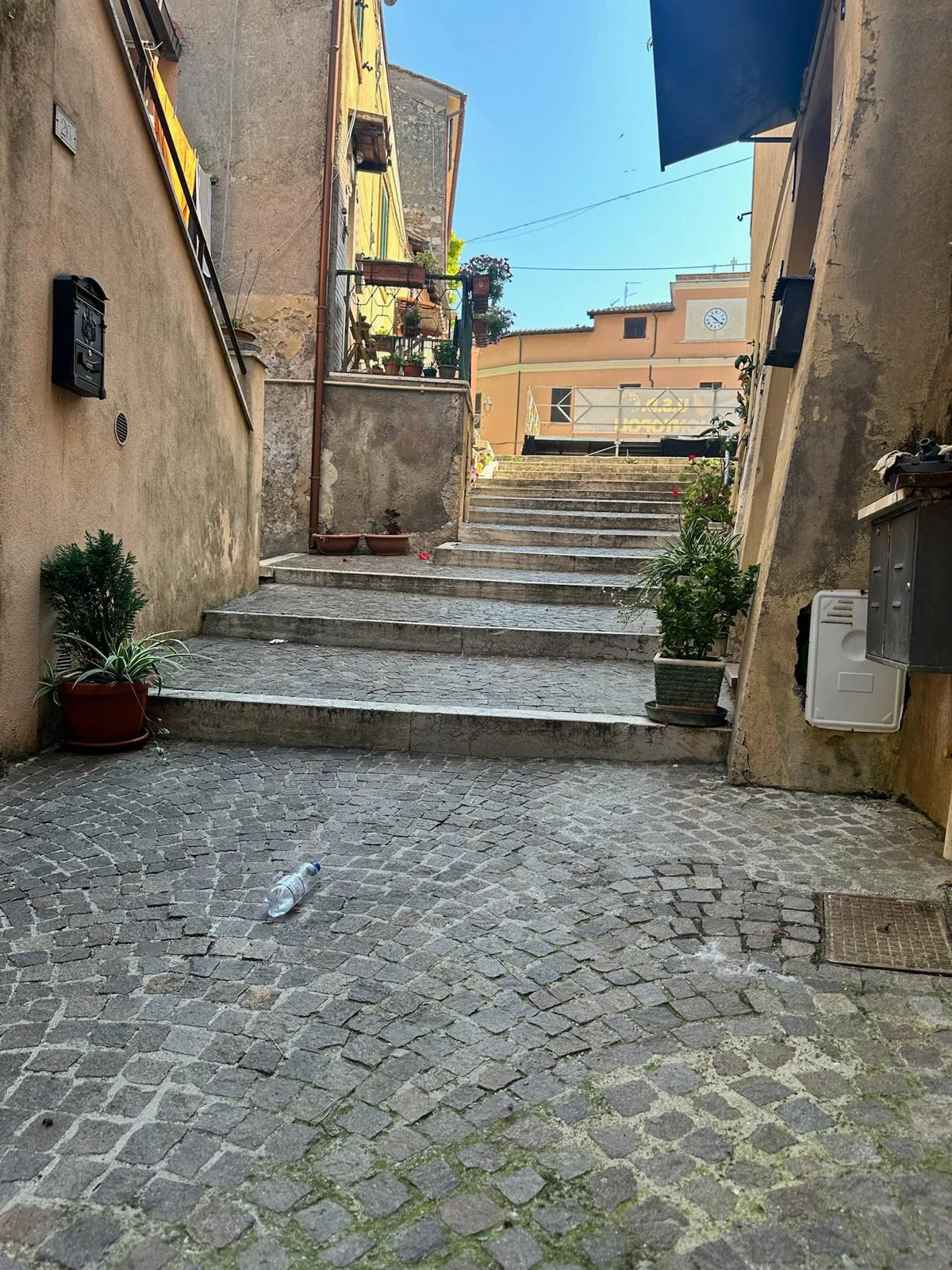
Old town and Torre Ugonesca
A stroll through the medieval lanes leads to the Torre Ugonesca (10th century), symbol of the village, with a spectacular view over the Tiber valley.
Open on the mapChurch of San Michele Arcangelo
The parish church in the heart of the village, home to fine works of local sacred art.
Open on the mapFlowered lanes and corners
Well-kept lanes, picturesque little squares and flowered corners: the perfect setting for photos of your stay.
Open on the map
10 minutes away
Poggio Mirteto, the heart of Sabina
Piazza Martiri della Libertà
One of the largest and most striking squares in the province, perfect for an open-air aperitivo facing the Church of San Rocco and the Cathedral of Santa Maria Assunta.
Open on the mapPorta Farnese and the old town
The monumental old gateway (1576) leading into the medieval core and the remains of the Bishop's Palace.
Open on the mapChurch of San Paolo
Just outside the centre, one of the oldest churches in the area (13th century), with a medieval crypt and period frescoes.
Open on the map
Within 20 minutes
Culture, history and enchanting villages
Farfa Abbey
One of the most famous Benedictine monasteries in Europe: a quiet, evocative place with guided tours of the old library and the basilica, surrounded by a village of artisan workshops.
Open on the mapCastelnuovo di Farfa and the Olive Oil Museum
In Palazzo Perelli, a unique museum blending contemporary art with the age-old tradition of Sabina PDO extra virgin olive oil.
Open on the mapRoccantica e Casperia
Two perfectly preserved medieval villages. Casperia is entirely car-free, with streets laid out in concentric circles: a true journey back in time.
Open on the map
Within 20–30 minutes
Nature, hiking and relaxation
Nazzano Tevere-Farfa Nature Reserve
A paradise for birdwatching and walks: rent a canoe, go hiking or book a boat trip on the Tiber.
Open on the mapFarfa Gorges
A natural monument where the Farfa river flows between rock walls. In summer it is perfect for refreshing hikes, river trekking and picnics.
Open on the mapRevotano sinkhole
Near Roccantica, a huge karst basin surrounded by woods and reached on foot along a trail: ideal for adventure lovers.
Open on the map
To experience
Flavours and experiences
PDO extra virgin olive oil tasting
Sabina is olive oil country: many historic mills in the area offer guided tours and tastings by reservation.
Open on the mapFriday market in Poggio Mirteto
A traditional weekly event: local produce, cheeses, cured meats and Sabina porchetta.
Open on the map
Day trips
Rome and Rieti
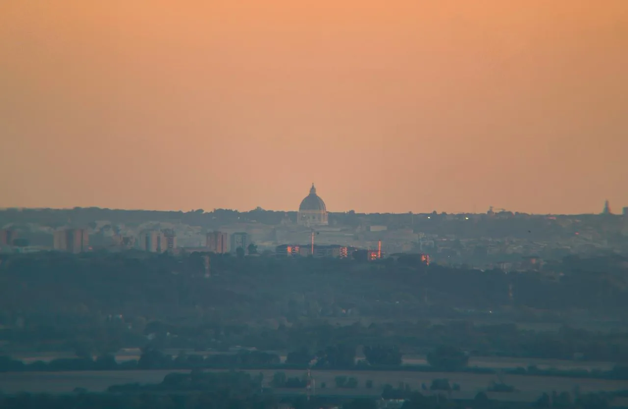
Rome
About 45 minutes by car, or by train from Poggio Mirteto Scalo. And from the terrace, with the binoculars, you can see St. Peter's Dome.
Open on the mapRieti
The capital of Sabina, with its old town, the Papal Palace and the square marking the Umbilicus Italiae, the geographical centre of Italy.
Open on the mapUnderground Rieti
A route beneath the palaces of the old town, along the ancient Roman viaduct of the Via Salaria: guided tours only, a fascinating journey into the Rieti of two thousand years ago.
Open on the map
30 minutes to 1¼ hours away
Day trips: history, lakes and mountains
Monte Soratte Bunker
Kilometres of tunnels dug into the mountain at Sant'Oreste: a shelter built in the 1930s, German headquarters during the war and later a Cold War nuclear bunker. Guided tours by reservation.
Open on the mapGreccio Sanctuary
Clinging to the rock above the Holy Valley of Rieti, this is where St Francis created the very first nativity scene at Christmas 1223.
Open on the mapLake Turano
An emerald-green lake among the mountains, with the villages of Castel di Tora and Colle di Tora overlooking the water: kayak, SUP, walks and lunch with a lake view.
Open on the mapMarmore Falls
Among the highest waterfalls in Europe (165 metres), created by the Romans over two thousand years ago. The water flow is released at set times: check the schedule before you go.
Open on the mapMonte Terminillo
"Rome's mountain" (2,217 m): skiing and snow in winter, hiking, mountain biking and fresh air in summer, with views across the Apennines.
Open on the map
Close at hand
Everything you need, all around you
Restaurants, groceries, a pharmacy, ATMs and the train station: Montopoli and the nearby villages have everything for your stay. Tap an item to see it on the map.
- Restaurants and trattoriasSabine cuisine and local dishes
- PizzeriasFor a casual dinner
- Cafés and breakfastCoffee, pastries and aperitifs
- Olive mills and Sabina PDO oilThe area's signature product
- Supermarkets and groceriesConad in Via Ferruti, Montopoli
- PharmacyMontopoli pharmacy, Via Roma 33
- Bank and ATMCash and banking services
- Train stationPoggio Mirteto Scalo, trains to Rome